Reading the Riparian Ribbon: Why Utah’s River Corridors Hold the Key to High Desert Life
The Emerald Threads of the Arid Plateau
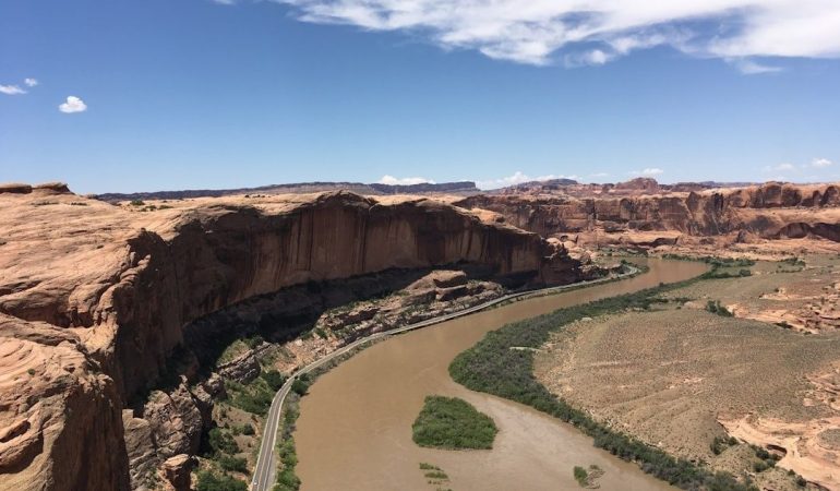
Across Utah, red rock slickrock rises in sculpted walls, mesas glow beneath a hard blue sky, and the desert can appear almost motionless from a distance. Then a river corridor comes into view. Fremont cottonwoods brighten the canyon floor, willows gather around a bend, and a narrow ribbon of green moves through country defined by rust, ocher, and sand. These riparian zones are not simply scenic accents. They are the living infrastructure of the high desert.
More than 70 percent of desert wildlife is understood to depend directly on river corridors, a striking reminder that abundance in arid country is often concentrated rather than widespread. For the thoughtful traveler, a riverside Utah escape offers an opportunity to read this landscape with greater attention. A quiet morning beside the water can reveal migration, pollination, shade, floodplain renewal, and predator-prey relationships unfolding within a few steps of a comfortable retreat. The most rewarding approach is that of a mindful naturalist, one who enjoys access to these oases while leaving their soils, banks, nests, and waters undisturbed.
Hydrological Sanctuaries Across the Great Basin and Colorado Plateau
Utah contains two remarkably different water stories. In the Great Basin, precipitation falls within an internally draining landscape. Water may evaporate, move underground, or collect in saline lakes rather than continuing toward the Pacific Ocean or the Gulf of Mexico. The Great Basin”s hydrographic boundaries encompass roughly 200,000 square miles, including much of Nevada, about half of Utah, and portions of several neighboring states. It is not one simple basin, but a collection of smaller enclosed basins shaped by mountain ranges, valley floors, snow, springs, and seasonal runoff.
Farther south and east, the Colorado Plateau presents a different visual and geological drama. Rivers such as the Green, Colorado, San Juan, and Virgin have cut deeply into layered sandstone and sedimentary rock, creating canyons where water appears both constrained and extraordinarily powerful. Along their margins, deep alluvial soils accumulate from flood deposits. In some floodplain and stream-terrace settings, a seasonally high water table lies within a few feet of the surface, allowing vegetation to flourish despite annual precipitation that may measure only six to twelve inches. These soils support cottonwood galleries, greasewood, perennial grasses, sedges, rushes, and other communities that would be impossible on exposed slickrock.
Riparian corridors also function as climate refugia. On a summer afternoon, the difference between open desert and a shaded riverbank can be substantial. Tree canopies reduce radiant heat, water cools the surrounding air, and moist soils sustain insects and green forage after upland vegetation has browned. This cooler, more humid microclimate serves birds, mammals, reptiles, amphibians, and travelers alike. It is why a riverside trail can feel restorative after a hot scenic drive, and why dawn and dusk are especially rich with movement. Springs and wetlands within Great Basin desertscrub similarly provide essential water, breeding, foraging, and stopover habitat, while fragile biological soil crusts help resist erosion on the surrounding slopes.
Keystone Engineers Shaping the High Desert Waterway
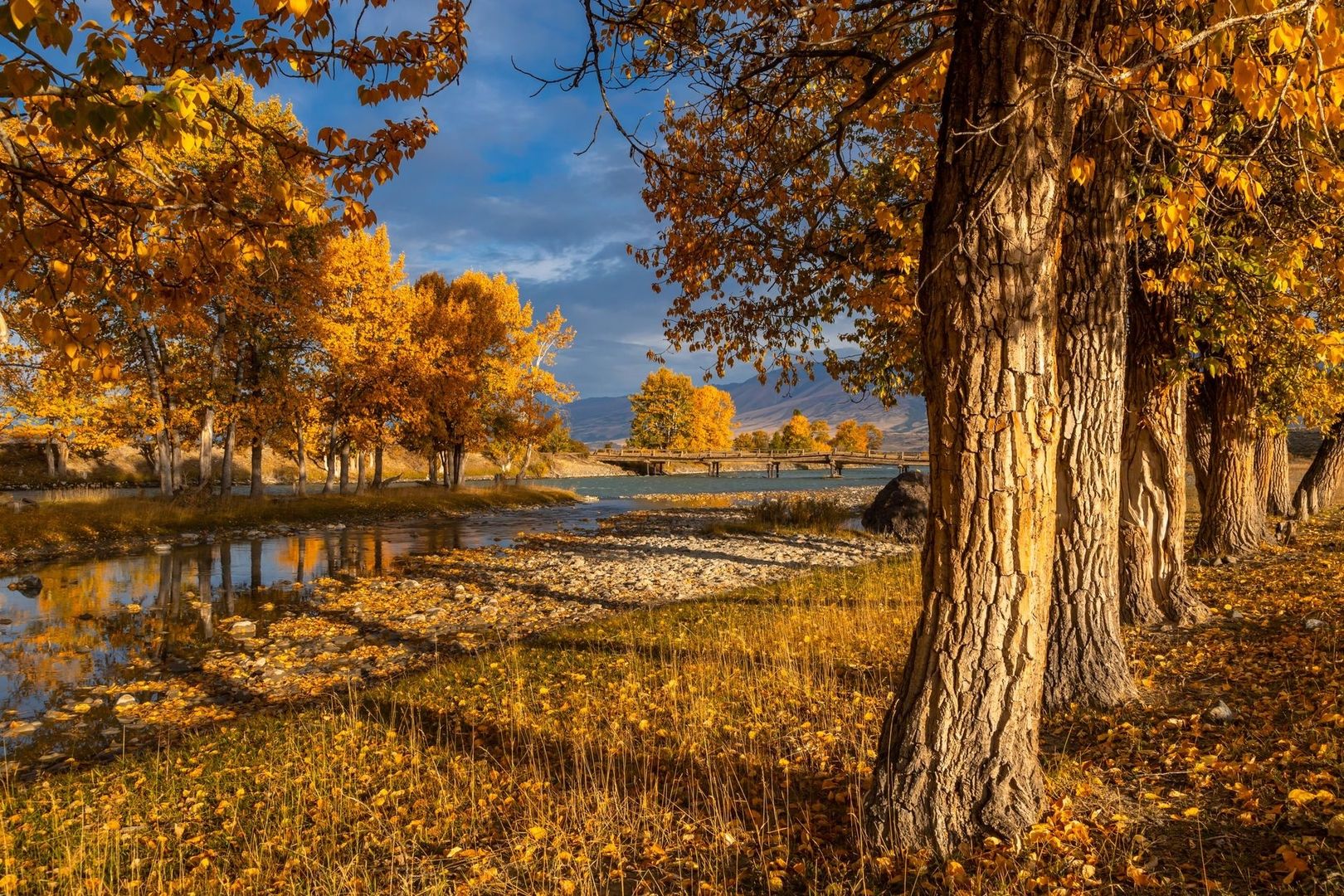
Fremont cottonwoods are among the most recognizable architects of Utah”s river margins. Their roots bind banks, their fallen branches create shelter, and their broad crowns provide shade for understory plants and wildlife. Cottonwood recruitment depends on the timing and force of floods. When high water scours a riverbank and later recedes, freshly deposited sediment can become a nursery bed for seedlings. In this sense, periodic flooding is not merely destructive. It is part of the renewal system that keeps a gallery forest connected to the river.
Beavers add another layer of hydrological design. By placing branches, mud, and stones across suitable channels, they slow water, raise local water tables, and create ponds and wetlands that hold moisture beyond the briefest runoff event. Their work can turn a fast-moving reach into a sequence of deeper pools, saturated meadows, and shaded side channels. These features provide breeding habitat for amphibians, refuge for juvenile fish, drinking sites for mammals, and abundant insect life for birds. In an arid landscape, a beaver-modified stream can resemble a distributed water-storage system built from living materials.
| Natural process | Effect on the corridor | Wildlife benefit |
|---|---|---|
| Flood deposition | Refreshes banks with sediment and creates seedbeds | Supports young cottonwoods and diverse understory plants |
| Tree roots and fallen wood | Stabilize banks and add physical structure | Creates cover for fish, insects, reptiles, and small mammals |
| Beaver dams | Slow current and retain water | Forms pools, wetlands, nurseries, and drinking places |
| Seasonal high water tables | Maintains moisture below and near the surface | Extends forage availability through dry periods |
The Green River illustrates how ecological value and cultural value can occupy the same corridor. Protected wild, recreational, and scenic segments preserve more than 350 miles of boating opportunity from Flaming Gorge Dam toward the Colorado River, while the river supports riparian, aquatic, terrestrial, and avian habitats. Several federally listed fish species rely on its waters, including reaches that provide spawning and nursery habitat. For guests planning a river-oriented stay, this is a useful perspective: a scenic float or riverside walk passes through a functioning system whose character depends on water quality, intact banks, native vegetation, and carefully managed access.
Wildlife Encounters Along Utah”s Vibrant Shorelines
Utah”s rivers are also aerial highways. The Green River and the Jordan River connect wetlands, reservoirs, floodplains, and upland habitats used by hundreds of neotropical migratory birds moving between North American breeding grounds and wintering areas in Mexico, Central America, the Caribbean, and South America. During spring and fall, a seemingly quiet stand of cottonwoods may hold warblers, vireos, flycatchers, tanagers, and other travelers feeding on insects before continuing their journey. Early morning is particularly rewarding, when cooler temperatures encourage activity and birdsong carries clearly across still water.
The shoreline community extends well beyond birds. Frogs and toads gather near pools, dragonflies patrol open water, and garter snakes may use the warm-cool boundary between gravel bars and vegetation. Mule deer browse in the shade, beaver sign appears along muddy edges, and desert tortoises use transitional habitats where forage and thermal shelter are available. In Washington County, the Mojave desert tortoise is protected through a formal habitat conservation plan because roads, development, and other activities can affect its recovery. Sightings should always be treated as a privilege rather than an invitation to approach, handle, feed, or photograph at close range.
- Fremont cottonwood, black-chinned, and yellow warblers moving through river trees during migration
- Great blue herons and green herons hunting in shallow water at dawn
- Osprey and bald eagles scanning larger rivers and reservoirs for fish
- Beaver, mule deer, and desert cottontails using shaded banks near dusk
- Western chorus frogs, spadefoot toads, and dragonflies around quiet pools and wetlands
- Garter snakes and collared lizards occupying warm edges near riparian vegetation
- Mojave desert tortoises in southern Utah, observed only from a respectful distance and never handled
The Thoughtful Field Guide for Discerning Desert Travelers
Riparian landscapes can feel resilient because they are green, but their margins are often exceptionally fragile. Biological soil crusts, sometimes called cryptobiotic crusts, may take years or decades to recover from a single misplaced step. These dark, textured communities of cyanobacteria, lichens, mosses, and fungi help hold soil together, capture nutrients, and reduce erosion. Bank vegetation is similarly vulnerable to trampling, especially where repeated foot traffic exposes roots or widens informal paths. Staying on established trails, rock surfaces, and designated crossings protects the very textures that make the river corridor healthy.
For comfortable wildlife watching, plan around the desert”s daily rhythm. Dawn brings cooler air, softer light, and active birds, while the final hour before sunset often reveals mammals, reptiles, and returning waterfowl. Midday is better suited to a shaded patio, a quiet meal, a swim, or a restorative pause at the resort. Carry water even beside the river, use binoculars rather than closing distance, and check local notices because nesting areas, seasonal closures, water conditions, and trail access can change.
- Before entering a corridor, review current guidance from the land manager and identify designated trails, overlooks, launch points, and restricted areas.
- Approach slowly and quietly, keeping voices low near dense vegetation, mudflats, ponds, and cottonwood stands where birds may be nesting.
- Remain on durable surfaces and avoid biological soil crusts, newly deposited sandbars, wet banks, and vegetated edges that function as nurseries.
- Keep dogs leashed where permitted, prevent them from entering water or chasing wildlife, and never allow them to investigate burrows or nests.
- Observe from a distance, using binoculars and a long lens. If an animal changes its behavior because of your presence, increase the distance.
- Pack out food scraps, fishing line, and all other waste. Do not feed wildlife, collect rocks or plants, or move natural materials.
- Leave the corridor quietly, with no trace beyond footprints on approved routes, so the next guest encounters the same sense of calm.
Carrying the Quiet Wisdom of the Desert Oasis Home
A riverside Utah retreat offers more than a picturesque setting for hiking, fishing, scenic drives, stargazing, or an unhurried evening outdoors. It provides a comfortable vantage point from which to understand how life gathers around water. The contrast between cool shade and open desert, between a cottonwood canopy and a sandstone wall, becomes more meaningful when the river is recognized as habitat, migration route, nursery, floodplain, and refuge all at once.
River conservation across the American Southwest depends on informed choices made by agencies, communities, landowners, and visitors. The restored Jordan River corridor demonstrates how trail planning, habitat work, transportation connections, and public stewardship can reinforce one another. Whether the occasion is a family getaway, a romantic escape, or a quiet naturalist holiday, the most memorable experience comes from approaching these emerald threads with intention. Let the water set the pace, let the wildlife keep its distance, and allow Utah”s delicate oases to offer their deepest lesson: in the high desert, the narrowest ribbons of life often sustain the widest world.