How Plateau Formations and River Valleys Shape Utah Microclimates
Understanding the Shifting Climates of Utah Red Rock Country
Utah”s red rock country is often introduced through its open skies, brilliant light, and dry air. Yet the desert is rarely uniform. A trail that begins on a sunlit sandstone bench may descend within minutes into a shaded corridor where flowing water, dense vegetation, and canyon walls create an entirely different atmosphere. For travelers planning an elegant escape with time for hiking, scenic drives, riverside relaxation, or a quiet evening beneath the stars, understanding those contrasts is one of the simplest ways to make each outing more comfortable.
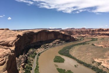
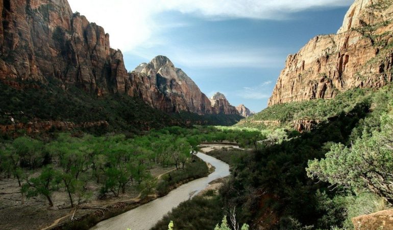
The visual transition can be extraordinary. Above the rim, exposed slickrock and elevated plateaus absorb the day”s radiant energy, while below, the Virgin River and other perennial waterways thread through cooler, more sheltered terrain. Elevation changes, canyon orientation, wind, shade, and water combine to produce temperature swings that can be felt over surprisingly short walking distances. A thoughtful itinerary therefore treats the landscape as a sequence of microclimates, beginning with crisp morning overlooks, moving toward shaded river corridors during the warmest hours, and returning to open viewpoints as evening breezes arrive.
Thermal Mechanics Above and Below the Rim
Plateau surfaces behave like broad natural heat collectors. Sandstone, gravel, and exposed soil receive intense solar radiation after sunrise, and those materials continue releasing stored warmth through the middle of the afternoon. Even when the regional forecast appears moderate, a rim trail with little shade can feel considerably hotter than the surrounding air temperature suggests. The effect is especially noticeable on pale, reflective rock, where direct sun reaches the skin and clothing without interruption. Morning may feel cool enough for a light jacket, yet the same route can become demanding by early afternoon.
River valleys create a contrasting thermal system. Shaded canyon walls limit direct solar exposure, while moving water and moist streamside soils moderate the immediate surroundings. Narrow corridors can also collect dense, cool air, particularly in the morning and after sunset. In practical terms, a river walk may feel 15 to 20 degrees cooler than an exposed plateau under comparable regional conditions, although the exact difference depends on season, canyon depth, wind, and recent weather. After a warm hike above the rim, the first stretch beside a stream can feel almost like entering an outdoor room with its own air-conditioning.
Riparian vegetation strengthens this buffering effect. Native cottonwoods and other streamside plants provide shade, slow wind, and help retain moisture close to the watercourse. The Virgin River corridor, for example, supports distinctive riparian forests, hanging gardens, native fish, and other communities shaped by the river”s continuing flow. This ecological richness is not simply scenic. It also signals a localized environment that differs markedly from broad, sparsely vegetated desert expanses and salt flats, where shade and evaporative cooling are minimal.
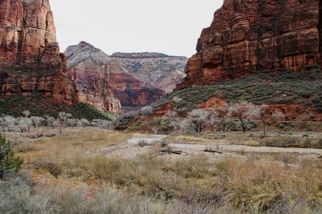
Utah”s daily range can be substantial because its dry atmosphere permits rapid heating after sunrise and rapid cooling after sunset. Elevation adds another layer of complexity, with higher formations often cooler than nearby lowlands even when they receive strong sun. Official park resources remain essential before setting out, particularly when a route enters a deep canyon or follows a watercourse. Reviewing Weather and Climate information for Zion National Park helps travelers account for changing conditions, alerts, and the possibility that a canyon bottom will feel very different from a nearby rim.
Microclimate Comparison Across Key Southern Utah Formations
Not every Utah landscape rewards the same schedule. Elevated sandstone benches are usually brightest and most exposed, with strong solar gain and little protection from wind. Enclosed slot canyons may remain cool well into the day, but their shade can also preserve morning chill and increase the consequences of sudden rain or runoff. Open valley basins occupy a third category, often allowing broad wind movement and uninterrupted sunlight. The most comfortable time depends on whether the priority is warmth, shade, photography, exertion, or a combination of all four.
| Landscape setting | Solar exposure | Morning feel | Humidity and cooling | Best comfort window |
|---|---|---|---|---|
| Elevated sandstone benches | High, with limited shade | Cool at first, quickly warming | Very dry, with strong radiant heat | Early morning or late afternoon |
| Enclosed slot canyons | Low to intermittent | Often cool and shaded | More moderated near water | Late morning through early afternoon in cooler seasons |
| Forested riparian bottoms | Filtered by cottonwoods and canyon walls | Fresh and potentially chilly | Highest local moisture and evaporative cooling | Midday during hot weather |
| Open valley basins and saline flats | Broad, uninterrupted exposure | Wind can amplify chill | Extremely dry, with little natural shelter | Early or late, depending on wind and season |
The contrast between a narrow Virgin River corridor and the Bonneville Salt Flats is particularly instructive. Along a river, water, vegetation, and canyon walls interrupt the desert”s full solar force. At the salt flats, the landscape is a vast, hard white crust with almost no natural shade. The Bureau of Land Management describes the Bonneville Salt Flats Special Recreation Management Area as a 30,000-acre remnant of ancient Lake Bonneville, where access can also be affected when the salt is wet or covered by standing water. Reviewing the Bonneville Salt Flats recreation guidance is important before planning a visit, particularly during permitted events or seasonally restricted conditions.
Geology determines more than the view. A dark or fractured rock surface may absorb and radiate heat differently from pale salt crust, while canyon orientation controls how long sunlight reaches the floor. Wind exposure can make an elevated overlook feel brisk even on a warm day, whereas a sheltered bend beside a stream may remain still and cool. For refined travel planning, the useful question is not simply whether the forecast says “hot” or “cool,” but where the route will be at each hour and what surfaces, vegetation, and water will be shaping the air around you.
Choreographing Your Day from Dawn Light to River Shallows
The most comfortable desert days are often choreographed rather than improvised. Begin on a rim trail or elevated overlook while the air is crisp and the rock is still releasing the previous night”s coolness. This is also an excellent time for long views, delicate shadows across canyon walls, and sustained uphill walking before radiant heat becomes intense. During the middle of the day, shift toward a forested riparian bottom, shaded canyon, or river-adjacent route, provided conditions and official advisories support that choice. Late afternoon brings an opportunity to return to open terrain, when lower sun angles and plateau breezes make panoramic viewpoints more inviting.
- First light on the high ground: Choose an exposed rim, bench, or overlook for photography and steady hiking. Carry a light insulating layer because the first hour can feel surprisingly cool.
- Midmorning transition: Descend while temperatures remain manageable, allowing time to enjoy changing geology and moving shade without rushing.
- Midday river refuge: Spend the warmest period near streamside vegetation or a protected canyon section. Water shoes may be appropriate where access is permitted and safe, but never assume a river crossing is necessary or advisable.
- Sunset elevation: Return to an open viewpoint for expansive scenery and cooling air. Build in enough daylight for the ascent and carry navigation, water, and emergency essentials.
Seasonality should shape the sequence. Late April through mid-June and late August through mid-October are often among Utah”s more pleasant periods, although conditions vary considerably by elevation and region. Summer outings benefit most from early starts, generous hydration, and deliberate use of shade. Winter brings shorter daylight, freezing temperatures, snow at higher elevations, and the possibility of valley inversions. Check current local forecasts, access notices, permits, and trail conditions before departure, and allow extra time when a route has unreliable cell service or changing weather exposure.
Essential Layering Strategies for Rapid Thermal Shifts
Layering is the most reliable way to move comfortably between plateau sun and canyon shade. A breathable merino wool or moisture-wicking synthetic base layer helps move perspiration away from the skin during exposed climbs, while still providing useful insulation when the route enters a cool corridor. Over that, a light mid-layer can be added during early morning, at windy overlooks, or after a shaded stream walk. The goal is not to carry a heavy wardrobe, but to create several small adjustments that prevent both overheating and an abrupt chill.
- Base layer: Choose merino wool or technical synthetic fabric that dries efficiently and remains comfortable during sustained exertion.
- Sun protection: Pack a broad-brimmed hat, sunglasses, sunscreen, and a lightweight UV sun hoodie. The hoodie can protect skin on open slickrock and serve as an extra layer near reflective water.
- Wind protection: A compact windbreaker is valuable on high benches and exposed viewpoints, where moving air can lower perceived temperature quickly.
- Warmth: Carry a packable insulated or fleece mid-layer during spring, fall, winter, and high-elevation outings.
- Water footwear: Quick-dry shoes with reliable traction can be useful around permitted river shallows, but sturdy closed-toe boots remain the safer choice for uneven trails.
- Practical reserves: Bring extra socks, rain protection, sunscreen, food, a first-aid kit, navigation tools, and substantially more water than the distance alone may suggest.
Comfort also depends on preparation beyond clothing. Break in footwear before a trip, protect electronics and maps from water, and avoid treating a visible stream as a dependable drinking source. Share the day”s route with someone, carry a charged external battery, and consider an emergency communication device where service is unreliable. For families and couples seeking a relaxed pace, a well-organized day pack makes it easier to pause beside the river, linger at a viewpoint, or return to a riverside property without turning every temperature change into a logistical interruption.
Plan Your Excursions Around the Natural Rhythm of the Land
Utah”s desert is most rewarding when its variations are welcomed rather than resisted. Plateau peaks offer clear horizons, radiant color, and energizing morning light. River channels provide shade, vegetation, birdsong, and a refreshing counterpoint to the exposed rock above. By moving between those environments at the right time, travelers can experience more of the landscape while reducing the physical strain that comes from remaining in the hottest or coldest setting for too long.
A considered schedule transforms a demanding trek into a calm, beautifully paced wilderness escape. Start high, descend toward cooler water, layer before the temperature changes, and reserve the open vistas for the gentle light of late day. Afterward, the return to refined riverside hospitality feels especially restorative: dusty boots can be set aside, cool air can replace desert heat, and the evening can unfold at an unhurried pace. With the land”s natural rhythm guiding each decision, Utah”s contrasting topographies become not an obstacle, but the defining pleasure of the journey.